
Santa Barbara ZIP Code Areas in the Regional Map
Santa Barbara County research has to separate the five principal incorporated-city shorthand areas from the broader regional map. City redistricting material names 93101 as Downtown and Westside, 93103 as Eastside and Riviera, 93105 as Uptown, 93109 as Mesa, and 93110 as Hope. The City GIS service shows nine ZIP values in the wider Santa Barbara-area context. That larger set reaches Montecito, Noleta, Goleta, and the UCSB area, so a ZIP code directory must not turn every postal value into a city resident list.
| Postal Code | Areas Covered | Post Office Context | Record-search Note |
|---|---|---|---|
| 93101 | Downtown, Westside, waterfront, and lower central city | Santa Barbara main and downtown delivery context | Core incorporated area with dense multi-unit and business addressing |
| 93102 | Santa Barbara PO-box mailing code | PO boxes and institutional mail | Non-geographic for situs research; never infer a parcel |
| 93103 | Eastside, Lower Riviera, Riviera, and eastern central areas | East Santa Barbara delivery context | Check the city line at hills and outer edges |
| 93105 | Uptown, San Roque, Oak Park, Samarkand, foothills, and western interior | Upper State and San Roque delivery context | Postal area reaches city and unincorporated edges |
| 93106 | UCSB institutional area in the Goleta and Isla Vista region | UCSB postal operation | Unique institution ZIP, not Santa Barbara city |
| 93108 | Montecito and Coast Village, with eastern postal Santa Barbara areas | Montecito delivery context | Much of the area is unincorporated and county-controlled |
| 93109 | Mesa, East Mesa, West Mesa, Shoreline, and the southern peninsula | Mesa delivery context | Core city area, but APN and unit checks still matter |
| 93110 | Hope, La Cumbre, Hidden Valley, and adjacent unincorporated territory | Northwestern Santa Barbara delivery context | Check City Limits before choosing a permit custodian |
| 93111 | Noleta and the eastern Goleta Valley | Goleta Valley delivery context | Generally outside Santa Barbara city despite the postal city |
| 93117 | Goleta, Isla Vista, and the western South Coast | Goleta-area delivery stations | Regional GIS value, not a Santa Barbara-city neighborhood ZIP |
Station names and current delivery assignments are not fixed by the local map. Use the precise address in the USPS ZIP Code Lookup before treating the returned code as current. Use the five shorthand labels only as local orientation, then use City Limits and the parcel layers to decide whether a search belongs with Santa Barbara city or Santa Barbara County.
The Santa Barbara GIS service supplies the local map layers used to compare ZIP areas and municipal geography.
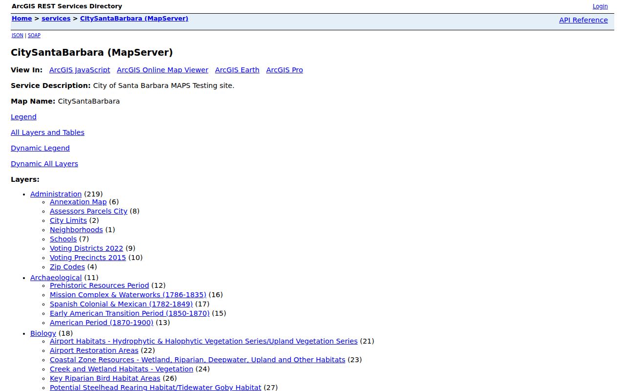
Its ZIP layer is a visual boundary aid. It does not disclose a complete resident roll, and its regional reach is the reason the postal value must be paired with a jurisdiction check.
USPS Delivery Areas Around Santa Barbara
USPS answers a delivery question: which postal code and mailing city belong to a particular deliverable address? That answer can differ from the answer to a Santa Barbara city question. A Montecito address may use Santa Barbara in its mailing line while county offices control permits. A Noleta address may also carry Santa Barbara as its postal city while sitting outside the incorporated boundary. The ZIP code directory is therefore strongest when it records both the returned postal result and the government jurisdiction.
Use the USPS address lookup for a current delivery check.
A USPS result can settle the mailing label, but it cannot establish who lives at an address or which agency holds a parcel record.
Santa Barbara Portals and ZIP Filters
A ZIP field does not make every local portal a ZIP-wide directory. The search mode determines what can be found, and several Santa Barbara systems are built for one parcel or one permit at a time. These differences matter when this directory is used for genealogy, a parcel study, or a civic records request.
| Portal or source | ZIP control | What the result can support |
|---|---|---|
| City Accela work-location search | ZIP is an optional address component beside street, city, and state fields | Refine a City permit or property record; search permit types separately |
| County Accela property lookup | ZIP field in address mode | Refine an unincorporated property search |
| City MAPS | Postal-area layer | View the postal shape against parcels, neighborhoods, City Limits, and annexations |
| Santa Barbara County Assessor | No ZIP field on the inspected landing form | Search by APN or house number plus street and optional unit |
| Treasurer-Tax Collector | Address substring and autocomplete, not a dedicated ZIP filter | Review parcel or bill records one address at a time |
| County Recorder | No ZIP or street-address mode advertised | Search a known party, document title, or document number |
County Accela is the path for property outside the incorporated city. City Accela begins in the 1990s and can fail when its official address differs from a familiar form, especially on multi-unit lots. City MAPS exposes the address point and APN; the Assessor and Treasurer turn that key into parcel or tax detail. The Recorder becomes useful only after a name or APN is resolved.
Finding Santa Barbara Residents by ZIP Code
A postal code can narrow a search, but it does not prove that a person lives in the postal area. Start with a defined question, such as locating parcels in one ZIP, checking a permit jurisdiction, or finding a historic community. Then keep the parcel, occupant, owner, and voter questions separate.
- Verify the exact address and current ZIP with USPS, including any unit or box distinction.
- Open City MAPS and compare the postal-area, City Limits, Neighborhoods, and Annexation Map layers. Note the APN and whether the parcel is inside the incorporated boundary.
- Choose City Accela for a city property or County Accela for an unincorporated property. Search by address or APN, and remember that permit types must be searched separately.
- Use the Assessor parcel form or Treasurer address search for parcel and tax clues. Their results are parcel-level evidence, not a list of every household member.
- For election research, use California My Voter Status only for the authenticated voter. A broader voter-file request requires an approved purpose under California law and is not a casual ZIP roster.
Once the ZIP narrows the area to a street, the address-keyed chain belongs in the Santa Barbara street directory workflow. That next step turns a broad postal area into individual parcels without claiming that the postal value itself identifies residents.
ZIP Code Boundaries and Santa Barbara City Limits
ZIP boundaries are delivery areas. City Limits and the Annexation Map are jurisdiction layers. In Santa Barbara County, 93108 reaches Montecito and Coast Village, 93110 reaches Hope and nearby unincorporated territory, 93111 covers Noleta and the eastern Goleta Valley, and 93117 covers Goleta and Isla Vista. Those areas can appear in a regional Santa Barbara directory while using county property and permit systems.
City MAPS places postal areas beside Neighborhoods, City Limits, APN, voting districts, and annexation layers. The County Surveyor interactive map provides a separate county parcel context. If a postal line says Santa Barbara, do not choose a custodian from that line alone. Check the parcel location, then follow the city or county access path.
Boundary check. A Santa Barbara postal code identifies delivery geography, not city jurisdiction. Confirm City Limits and annexation status before requesting a permit, parcel, or tax record.
- ZIP versus ZIP+4
- A postal code names a delivery area; ZIP+4 adds a more specific delivery segment and still does not identify a household.
- PO-box ZIP
- A code used for post-office boxes or institutional mail rather than a polygon of residential parcels.
- Unique ZIP
- A code tied mainly to one institution, such as the UCSB area represented by 93106.
- Carrier route
- A postal delivery grouping inside a service area, not a city neighborhood or public resident roll.
Why Santa Barbara 93102 Is a Mail Code
93102 is the clearest local warning against treating a mailing code as a parcel key. Research identifies it as a Santa Barbara PO-box mailing code, and the City itself uses a 93102-1990 PO-box line. The code is not shown as a polygon in the City mapped postal layer. A 93102 result can tell a researcher where correspondence is addressed, but it does not locate a home, lot, or resident.
For a box, keep the USPS assignment and the physical address separate. For a property, return to the situs address, APN, or legal description. The Treasurer may accept an address substring, and the Assessor may accept a house number and street, but neither should be asked to turn a PO-box code into a citywide occupant list. This is a geography issue, not a missing search button.
Note: 93102 can identify a Santa Barbara mailing box, but it should never be treated as a physical parcel address.
Santa Barbara Address Names Across Time
ZIP research also depends on older street names and numbers. Captain Salisbury Haley’s 1851 survey imposed an American grid over older pueblo paths, but blocks were not uniform. The City later formalized State Street business and residence numbers in 1875. A modern map can therefore suggest a clean numerical pattern that an older deed, directory, or permit does not share.
The documented Indio Muerto Street to Hutash Street change is a useful bridge. Council approved the rename on September 29, 2020, it took effect December 14, 2020, street numbers stayed the same, and USPS accepted both names for one year. Search both names when a Santa Barbara postal record crosses that period. City MAPS and the City history page can help, but older records may still use the former name.
Annexation creates a second time problem. A parcel may have County-era permits and later City files, so use the Annexation Map and search both custodial layers when the history spans the change.
Census Context for a Santa Barbara ZIP Code
Citywide Census context helps explain why a postal directory is not a resident census. The Census Bureau’s QuickFacts page estimates 86,422 Santa Barbara residents on July 1, 2025, compared with a 2020 census count of 88,665. It reports 19.51 land square miles and 4,545.3 people per square mile in 2020. Those figures describe the incorporated city, not each ZIP value in the regional GIS layer.
The same source reports 39.9 percent owner-occupied homes for 2020-24 and a median owner-occupied value of $1,570,800. That share warns that an Assessor owner result is a poor proxy for a full Santa Barbara resident roll. Preserve the difference between an owner, mailing recipient, occupant, and approved record subject.
The Census QuickFacts source for Santa Barbara provides the citywide definitions and scope behind these figures.
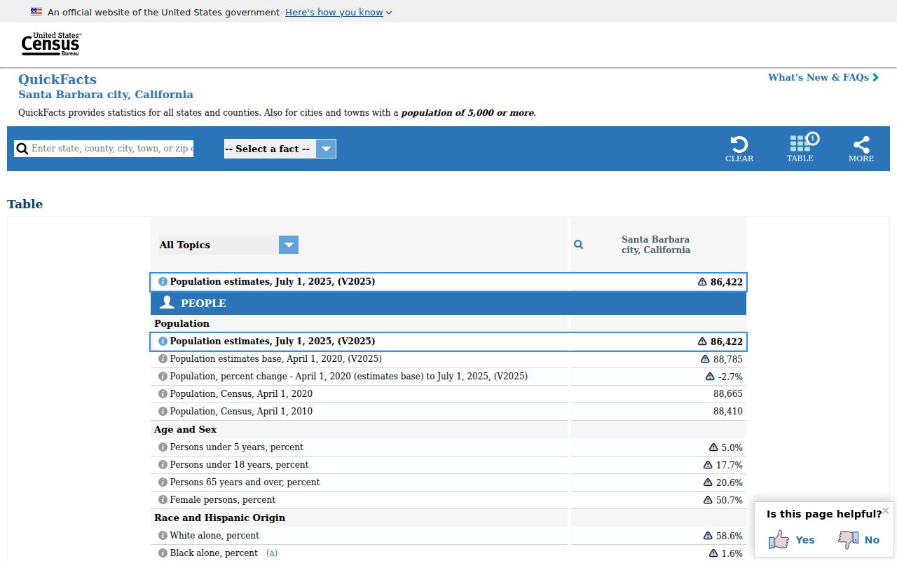
No inspected official source publishes per-ZIP population or registration totals, so this directory should not invent a count for any local code.
What the Santa Barbara ZIP Code Directory Can Prove
A ZIP code can support delivery verification, regional comparison, and the first cut of a parcel or permit search. It can also expose a jurisdiction trap before a request is sent to the wrong office. It cannot prove that every person associated with a parcel lives there, and it cannot convert a postal area into a public household roster.
Keep situs, mailing, and legal description separate. A PO box, trust, agent, or out-of-area owner can make mailing evidence look like a residence when it is not. My Voter Status is authenticated self-service, not a public name search. If a portal stops, use the custodian, counter, archives, or a focused California Public Records Act request.